Excerpt - chapters 1 & 2
History of Metropolitan Planning Organizations
Monograph from a series of articles - January 1998
By Mark Solof
The United States may be one nation under God but, politically, it is
fractured into a multitude of jurisdictions — states, counties,
municipalities, school districts, election wards and more. While
necessary for governance, taxation and administration of public
services, these jurisdictions, for the most part, bear little relation
to the distribution of population and economic activity across the
landscape.
Over the last century, the settlement of land in
ever-widening rings around the nation's major cities has created
regional economies that span local government boundaries and often
state lines. In effect, the invisible hand of the market has shaped
the man-made landscape with little regard to the formal divisions
decreed by government.
The federal government has
recognized this organic, market-driven growth process by identifying
over 300 "metropolitan areas" across the country. According
to the U.S. Census Bureau, each consists of "a core area
containing a large population nucleus, together with adjacent
communities having a high degree of economic and social integration
with that core."
The federal government has also
recognized that the integrity and vitality of these areas are
dependent on the large-scale circulation of goods and people over
regionwide transportation networks. Yet the fragmented political
authority in most metropolitan areas makes it difficult to address
regional transportation impacts and needs.
For over two
decades, the federal government has sought to address this failing by
requiring states to establish Metropolitan Planning Organizations
(MPOs), composed of local elected officials and state agency
representatives, to review and approve transportation investments in
metropolitan areas.The North Jersey Transportation Planning Authority
is the MPO for northern New Jersey.
But because they bridge
traditional boundaries and lines of authority, from the start, MPOs
have been controversial. Critics have argued that they usurp
legitimate functions of state governments and constitute an
unnecessary layer of bureaucracy. Supporters say they are important
mechanisms for insuring local control over federal funding and that
they deserve wider authority to implement the plans they create.
Congress,
while consistently upholding the need for MPOs, periodically has
refined their functions and authority. During the fall of 1997, it was
in the midst of doing so again as it considered reauthorizing the
Intermodal Surface Transportation Efficiency Act, the enabling
legislation for MPOs .
To provide historical perspective on
this Congressional debate, the NJTPA published a series of three
articles on the history of MPOs which appeared in the NJTPA Quarterly
during 1996 and 1997. The articles made use of secondary sources to
sketch the origins and administrative history of MPOs in the context
of the broader developments in the nation, government and the field of
regional planning. This publication provides the full text of the
history series with added source notes and a bibliography.
Chapter 1 - Origins of Regional Planning: 1900-1940
Growth of the nation's metropolitan areas was made
possible and sustained by improvements in the transportation system.
In the 19th century, canals and then railroads helped knit together
local and regional markets into a single national economy. Cities with
long-established marine ports such as New York and those situated at
the hub of major rail routes such as Chicago became the command
centers for the emerging national economy. Their industries took in
raw materials and fed back finished goods to the rest of the nation.
They also served as the headquarters of new business organizations,
nationwide in scope, which generated growing numbers of well paying
jobs, swelling the ranks of the middle class.
As the cities
prospered, they drew in waves of immigrants from around the globe.
Soon, new innovations in transportation — horse-drawn railways,
electric streetcars and finally, the automobile — provided the
circulation systems needed for further growth, spreading population
and productive capacities into wide regions around the urban core.
Each city came to sit "like a spider in the midst of its
transportation web," according to Lewis Mumford.
Imposing
order on the rapid and often chaotic growth of metropolitan areas
initially became the cause of Progressive Era reformers, academics and
specialists in the new field of city planning. While their most
visionary plans were never realized, they conducted important studies
of regional needs and laid the groundwork for eventual federal
programs to support comprehensive regional planning. This chapter
traces the origins of regional planning in the first decades of the
century.
Progressive Roots
Recognition of the need for planning on a regional scale
has its roots in the "Progressive Era," roughly
the
first two decades of the century. This was a time of great optimism
for the growing middle class, when science was seen as offering the
path to a more prosperous, efficient and orderly future. Applying
scientific principles, industry helped satisfy material wants through
mass production of goods and helped ease domestic burdens with a
succession of new electric appliances.
Meanwhile, a new
intellectual elite of "social" scientists promoted the
reorganization of public and private institutions along more rational
lines. In consort with business leaders and reform-minded politicians,
this elite initiated a variety of crusades to improve the lot of the
mass of people, economically and socially. They advocated government
run by civil servants, breakup of monopoly companies, "home
economics," compulsory education beyond grade school and
prohibition of alcohol.
One of the great challenges faced
in the Progressive Era was massive urbanization. Cities were growing
rapidly as a result of both unprecedented immigration as well as the
influx of population from rural areas. Social reformers, taking aim at
overcrowded and unhealthful living conditions, pressured city
governments to institute sanitation and building codes. Later they
fought haphazard development patterns, including the siting of
commercial and industrial facilities in residential neighborhoods. In
response, cities drew up plans for segregating land uses and
instituted the first zoning ordinances to enforce them.
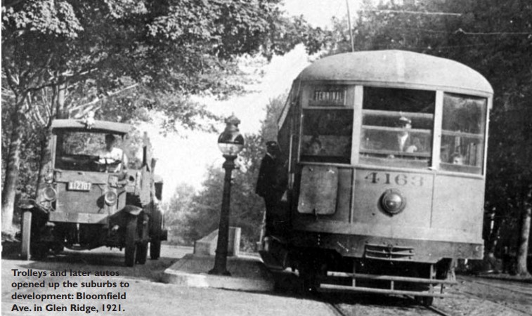
Cities
were also expanding outwardly. Many families fled inner-city crowding
to homes in suburbs that had access to city jobs via streetcar or
commuter rail lines. By the 1920s, as automobile ownership grew, wider
areas were opened up to settlement, with many rural villages
transformed by a wave of housing development for urban commuters. Most
of this growth occurred with little forethought or government
intervention. Indeed, existing government structures could only
address the trends on a piecemeal basis and, as a result, many
problems were left unaddressed including mounting highway congestion,
polluted rivers, disappearing open spaces and inadequate water and
sewer systems. It was only natural that the
Progressive Era
emphasis on promoting rational organization would be brought to bear
on the growing dispersion of population and economic activity in broad
regions around major cities.
Practical Needs
The first efforts at regionwide planning began in the
1920s. While academics provided the theory and social science tools
for regional planning (see sidebar p. 8), practical considerations
motivated their use. For instance, by the end of World War I, a
long-running dispute between New York and New Jersey over rail freight
business reached a point where only a solution at a regional scale was
possible. The dispute centered on rates charged by rail companies that
encouraged goods to be moved from rail terminals in New Jersey to
ships berthed in New York. New Jersey claimed the rates limited the
development of maritime business on its side of the port. At one
point, a lawsuit threatened, Solomon-like, to split the port into two
zones, reducing its ability to efficiently serve shippers and leading
to the loss of business to other East Coast ports.
New York
business leaders recognized the threat and proposed a new bi-state
agency to provide unified planning and policies for the port. Backed
by the federal Interstate Commerce Commission, the business leaders
finally succeeded in 1921 in getting the two states to create the Port
of New York Authority (later to become the Port Authority of New York
and New Jersey). The authority was the first interstate governmental
body in the nation and the first special-purpose "authority"
with power to issue bonds and make investments while insulated from
political control. In its first year, the Port of New York Authority
set about developing a comprehensive plan for improving the entire
port with new terminals and connections among rail lines
As
this ambitious port plan took shape, other planning efforts were
initiated to address a host of emerging regional-level problems.
Again, New York area business leaders, together with a growing number
of professional city planners, broke important ground. In the early
1920s, the Russell Sage Foundation appointed a committee to develop a
"Regional Plan of New York and Its Environs." The work grew
into a massive undertaking, including extensive surveys, data
collection and economic projections, focusing upon New York City and
500 communities in three states within commuting distance of
Manhattan. The pioneering work would continue for most of the decade
during which most other major cities in the U.S. initiated similar
"comprehensive" regional plans.
The first volume
of the New York plan was issued in 1929 and presented recommendations
on nearly every aspect of regional development, including calls for
the development of satellite cities in outlying areas, the control of
land-use to preserve open spaces and the construction of new rail and
highway networks.
Implementation of such a far reaching
plan was problematic. The authors hoped that the logic of their
recommendations would do much to promote voluntary compliance by
affected governments in the tri-state region. A private planning
organization, the Regional Plan Association, was created to promote
this compliance and conduct follow-up research.
However,
the experience of the Port of New York Authority did not bode well for
achieving voluntary compliance. Lacking power to force cooperation
among the highly competitive freight rail companies in the region, the
Port Authority was blocked in implementing many elements of its plan
for creating an integrated freight rail network.
Critics
argued that the recommendations of the Regional Plan of New York, and
of comprehensive plans elsewhere in the country, would be similarly
blocked by the competing interests of local governments. One planning
professor, Thomas Reed, in 1925 contended that the only way to insure
effective regional planning was the creation of "areawide"
governments with power over municipalities in setting policies for
regional infrastructure.
The Great Depression
Questions about the implementation of comprehensive plans
in New York and other cities became all but moot in the face of the
economic collapse of the Great Depression. Where toll or other
dedicated funding sources were available or where the federal
government would foot the bill, selected infrastructure projects
recommended by regional plans were built. The New York region fared
particularly well, with the George Washington Bridge, Lincoln Tunnel
and other major transportation facilities built in the 1930s.
But,
by-and-large, visions of promoting orderly urban regions with planned
communities and efficient infrastructure systems, were abandoned as
cities struggled with desperate social and economic conditions.
Still,
the regional planning experience of the 1920s exerted an important
continuing influence. Through the empirical techniques of the social
sciences, planning efforts in major cities had documented the regional
nature of many social and economic problems. In doing so, they also
created a strong case for new institutions and decision-making
mechanisms such as authorities and regional planning commissions to
supplement fragmented political structures.
The federal
government, for its part, carried the torch of regional planning
forward as it intervened to revive the economy in the 1930s. President
Roosevelt, with great interest in natural conservation, encouraged and
supported cooperative planning by governments in river valleys to
address flood control, soil erosion and other shared needs. He also
initiated a massive federal experiment in regional planning by
creating the Tennessee Valley Authority which addressed not only water
resources issues but electrification, agricultural improvement,
housing and economic development.
Many New Deal programs
were administered regionally and encouraged cooperation among local
officials. The Public Works Administration, in particular, helped
state and local governments develop the planning capabilities needed
for large-scale infrastructure projects. But there was a catch.
Planning was to be in accordance with national standards as a
condition for the receipt of federal infrastructure aid. This
requirement set the pattern for future intergovermental relations: the
federal government used aid as a lever for promoting achievement of
national goals and for persuading state and local governments to look
beyond their narrow self-interests in making infrastructure and social
investments.
Chapter 2 - Regional Responses to the Suburban Land Rush:
1940-1969
At the end of World War II, America was transformed by
rapid suburbanization which brought housing, retail and other
development sprawling out in every direction around major urban
centers. As the transformation proceeded, public and private leaders
recognized that existing government structures were inadequate to deal
with the problems that arose — not the least of them, inadequate
transportation, water and other infrastructure systems, the loss of
open spaces and the decline of urban neighborhoods.
This
recognition prompted the creation of numerous regional planning
bodies. With regulatory and financial backing by the federal
government, these bodies by the 1960s took on a variety of official
planning functions for their regions. Still, they were seldom able to
exert influence over the land use decisions of local governments or
the transportation decisions of state agencies which helped drive the
continuing suburban land rush.
This chapter traces the
post-war developments in regional planning that set the stage for the
formal establishment of MPOs in the early 1970s.
Preparing a New Future
During World War II, government and industry leaders were
keenly aware of the need to plan for the post-war period. After a
decade or more of pent-up demand for housing and consumer goods, the
nation was poised for an unprecedented peacetime economic boom.
However, the leaders knew that if this demand was not capitalized upon
effectively, the nation could easily slip back into the unemployment
and stagnation of the pre-war years.
Thus, alongside the
patriotic fervor for the war effort, planning for a new post-war
America became a national preoccupation. In a number of major cities
regional alliances were launched in which public officials joined
forces with private industry and surrounding local governments to
chart strategies for their post-war future. Their efforts were
supported at the federal level by the National Resources Planning
Board (NRPB), until it was disbanded by Congress in 1943. The agency
urged a "comprehensive" approach to post-war planning that
would make use of surveys and community forums and recognize "the
interrelatedness of problems of population, economic activities,
social patterns [and] physical arrangements."
But by
and large the alliances paid little heed to urgings of NRPB for
comprehensive planning-or even to the lessons learned in the 1920s
about the problems of unfettered regional growth. The dominant view
was that, if regions were to seize the coming economic opportunities,
bold initiatives would be required. Rather than engage in the cautious
planning advocated by the NRPB, most regional alliances focused upon
preparing housing, business development and infrastructure projects
that could be quickly implemented with the war's end.
Planning
new freeways became a favored activity. Many of the regional
transportation systems envisioned were straight out of the General
Motors' "Futurama" exhibit at the 1939 World's
Fair — cities linked and served by networks of congestion-free,
limited-access highways that presumably would make the nation's
crowded and run-down mass transit systems a thing of the past. In
1944, Congress gave its endorsement to this "motor age"
vision with initial authorization for construction of a nationwide
interstate highway system. If the nation was to move boldly into the
future, apparently it would do so solely by automobile.
Suburban Land Rush
By the end of 1946, 10 million men and women were
discharged from the armed services and new family formation rose to a
record 1.4 million per year. The need for new housing to accommodate
them reached near-crisis proportions. The national housing agency
estimated that five million new housing units were needed immediately
and 12.5 million would be needed over the next decade.
Private
developers jumped at the opportunity. Using pre-fabricated materials,
cookie-cutter plans and standardized construction techniques to create
"tract" housing developments, the developers sought to
attract veterans — with their generous GI mortgage benefits — and
middle class urban dwellers eager to enjoy the privacy and amenities
of new, detached suburban homes.
The most aggressive and
successful of the private developers was Levitt and Sons, who
transformed potato farms on Long Island into the 17,000-home
Levittown, creating the model for similar communities in Pennsylvania
and New Jersey. By 1950, according to one estimate, Levitt was
producing one four-room house every 16 minutes.
But blacks
and other minorities were generally not welcomed. Even after 1948 when
the U.S. Supreme Court ruled that clauses in sales agreements
discriminating against minorities were unenforceable, many contracts
still contained them and realtors and developers used
"steering" and other methods to keep non-whites out of prime
suburban locations.
Still, in all, three-fifths of all new
housing in the late 1940's was built in the suburbs. On the heels
of the suburban housing boom, retailers, manufacturers and other
businesses sought out suburban locations, resulting in an increas- ing
dispersion of economic activity that had long been compacted in and
around major cities.
The dispersion, in addition to meeting
the material and employment needs of the new suburbanites, was viewed
by military officials as having strategic benefits, making the
nation's population and productive capacities less vulnerable to
nuclear attacks against major cities. Architect Frank Lloyd Wright put
it bluntly: "The urbanite must either be willing to get out of
the city or be resigned to blowing up with it." This cold-war
calculus provided further impetus to national-level support for a
continuing suburban land rush.
Federal Planning Aid
Inevitably, many rural communities faced growing pains in
accommodating waves of new residents. In some areas, the pains became
outright sickness. Symptoms included poorly laid-out housing
developments and inadequate schools, roads and water and sewer
systems. Many homeowners also faced their share of woes from slapdash
building methods, including leaky roofs and faulty sewer hookups.
Planner and historian Lewis Mumford, surveying the growing chaos in
many areas, termed it "the suburban fallout from the metropolitan
explosion."
The nation's cities, too, were
shaken. The loss of middle class residents and business further
exacerbated the social and economic problems that had received scant
attention through the long years of economic depression and then
war.
Congress responded with major housing legislation,
first in 1949 and again in 1954. The acts primarily supported
continued suburban development, with financing and insurance programs
benefiting both homebuyers and builders. But the acts also authorized
federal aid to cities for urban renewal and public housing and
supported new regional planning efforts. Section 701 of the 1954 Act
for the first time gave federal grants for councils of governments and
other metropolitan planning agencies to promote cooperation in
analyzing and addressing regional problems.
Testifying
before Congress, urban planning professor Robert Mitchell argued that
such planning aid was needed to build "awareness that central
cities and suburbs are interdependent and cannot survive in the
present governmental and physical chaos."
The federal
aid proved popular, prompting the formation of nearly 100 metropolitan
planning bodies. Yet, while the new agencies improved
intergovernmental cooperation, they generally were hamstrung by their
inability to directly shape local government land use policies.
Indeed, many local officials supported regional planning only to the
extent that it would sustain their capacity to accommodate the
windfall of development projects coming their way.
Some
communities chose to go it alone, hiring consultants to develop master
plans that would rein in the more disorderly aspects of growth. The
extreme case was the community of Mountain Lakes, New Jersey, which
purchased all the town's vacant, developable land to be parceled
out only for those projects that fit the sensibilities of its wealthy
residents.
Interstate Highways
The ambivalence on the part of local officials towards
regional planning changed dramatically with the 1956 Federal Aid
Highway Act. The legislation authorized construction of the
multi-billion dollar, 41,000 mile interstate highway system as well as
providing aid for primary, secondary and lesser roads. The system
constituted the largest construction program in the nation's
history, on the scale of 60 Panama Canals. With the choice of routes
left up to state highway departments, many local officials found new
cause to embrace cooperation through metropolitan planning agencies to
avoid having routes imposed on them and to gain bargaining clout in
negotiations with their states.
Still, the resulting
cooperation had few of the features of the comprehensive regional
planning advocated years earlier by the NRPB when the interstate
system was conceived. Rather much of the "planning" was of a
narrow, technical nature focusing on routing alignments. Despite the
urging of the planning community, the Act did not require routes to
conform to metropolitan plans already in place or to give
consideration to crucial land use issues, such as how particular
routes could open up wide areas to new waves of suburban development
and sprawl. Also the Act all but neglected the further damage that
could be done to urban transit systems, which already were pitched
into a steep decline due to competition with the automobile.
The
decision to forge ahead with the massive interstate highway system
with only dim recognition of its potential consequences partly stemmed
from the influence on Congress of those with something to gain from
the system — the defense establishment, developers, auto manufactures,
oil companies, state and local engineers and others.
But it
also reflected a peculiarly-1950s outlook about the future. It was a
decade of national self-assurance when American industrial and
military might dominated much of the world. Any challenges which might
appear on the horizon, the view went, would yield to technology and
American ingenuity.
Faith in the future was also strong
among transportation officials in the 1950s. Even the demise of mass
transit systems was seen as amenable to technical fixes. For instance,
a 1956 Brookings Institution report stated that "In the coming
decade the development of regional mass transportation by helicopter
or convertiplane may provide the longer distance commuting services
now provided by interurban buses and commuter rail lines."
All
this added up to a confidence in building large-scale projects in the
name of progress, leaving the consequences to be sorted out later. It
was an outlook personified in "master builder" Robert Moses
who, from the 1930s on, oversaw the construction of major highways,
bridges and parkways in and around New York City — as he lashed out at
"ivory tower planners" for being preoccupied with potential
complications.
Three-C Planning
By the late 1950s, the effects of a decade or more of
rapid suburban growth began to dampen the widespread "build it
now" enthusiasm. Many planners and public officials were alarmed
at the nation's changing landscape. In 1958, planner William
Whyte noted that a traveler flying from Los Angeles to San Bernardino
"can see a legion of bulldozers gnawing into the last remaining
tract of green between the two cities." On a flight over northern
New Jersey, he said, the traveler "has a fleeting illusion of
green space, but most of it has already been bought up and outlying
supermarkets and drive-in theaters are omens of what is to
come."
These concerns led to studies during the
Eisenhower Administration of new government structures and policies
that could help improve local planning and coordination. Many study
recommendations were enacted under the Kennedy Administration as part
of the Housing Act of 1961 which provided grants for mass transit and
open space preservation and expanded funding and incentives for
metropolitan transportation planning.
A further, and
historic, step in addressing the problems of rapid suburbanization
came with the enactment of the Highway Act of 1962. It made federal
highway aid to areas with populations over 50,000 contingent on the
"establishment of a continuing and comprehensive transportation
planning process carried out cooperatively by state and local
communities." This required planning process, known as
"three-C" planning for its continuing, comprehensive and
cooperative features established the basis for metropolitan
transportation planning used to the present day.
While
regional cooperation and comprehensiveness had been long-sought goals
of the planning community, the Act's requirement for continuous
planning recognized that in a rapidly changing and increasingly
complicated environment, which included dramatic population growth
resulting from the post-war baby boom, regional plans had to be
dynamic documents, subject to revision based on continuing data
collection and feedback. Advancements in computer technology and
social science research techniques became important tools for
conducting this continuous planning.
Three-C in Practice
In the year following the adoption of the 1962 Act,
governments throughout the country scrambled to put in place the
required three-C process. The response of officials in the New
York-New Jersey-Connecticut metropolitan region was typical of major
urban regions. Since the late 1950's, the non-profit Regional
Plan Association, with input from many of the area's officials,
had been developing a comprehensive plan for meeting the region's
infrastructure needs. As a result of the 1962 Act, a new official
body, the Tri-State Regional Planning Committee (later the Tri-State
Regional Planning Commission), was created to build upon this planning
effort and administer the region's three-C transportation
planning process. A number of similar metropolitan planning bodies
were created across the country and some existing voluntary and
quasi-official regional bodies gained official status.
Despite
the high initial expectations created among many planners by the new
organizations and the enlightened nature of the three-C requirements,
the weaknesses of the Act became clear in subsequent years.
Implementation of the Act was the responsibility of the federal Bureau
of Public Roads (BPR) which was closely allied with state highway
departments and organizations dedicated to roadway construction.
According to urban planning professor Thomas A. Morehouse, the three-C
planning requirement was seen by these highway interests as "a
potentially disruptive innovative force, threatening established
policies, procedures, commitments and systems of
decision-making." Of particular concern to highway interests was
the possibility that local officials acting through new regional
organizations — with mandates for comprehensive planning in hand —
could block or slow construction of segments of the interstate system
which were then were being pushed through densely populated
metropolitan areas.
To avert the threat, BPR interpreted
the Act in ways that preserved the authority of state highway
departments. For instance, states were able to fulfill the
"cooperative planning" requirement by negotiating agreements
directly with local governments, bypassing though it was now tempered
by somewhat greater local participation and informed by increasingly
sophisticated technical studies. These agreements typically allowed
local officials to participate in technical studies, initiated and
dominated by state highway departments, for planning the
implementation of specific roadway projects or for establishing
long-range regionwide capital plans. Land use, mass transit and social
issues were usually given only passing consideration.
One
result of BPR's "artful" interpretation of the required
three-C process was that regional planning agencies were left largely
as adjuncts to state highway departments which relied upon them for
collecting and interpreting data and perhaps for input on how road
construction within their regions should proceed. In effect, the 1950s
"build it now" approach to project development lived on in
the 1960s, though it was now tempered by somewhat greater local
participation and informed by increasingly sophisticated technical
studies.
1960s Progress
While many of the hopes of the early 1960s were never
fully realized, the cause of improved regional planning was by no
means vanquished. With crucial support by President Johnson and his
political allies, major transportation and housing legislation during
the decade progressively expanded the role and authority of regional
planning agencies (see box, right). In his message to Congress shortly
after his election, Johnson noted that in confronting housing,
transportation or other urban problems, metropolitan planning was
needed to "teach us to think on a scale as large as the problem
itself and act to prepare for the future as well as repair the
past."
In addition to new responsibilities in the
areas of environmental and transit planning, regional bodies were
entrusted with reviewing all applications for federal aid to insure
they were consistent with areawide plans and were coordinated with
other federal-aid projects.
Though carefully crafted to
preserve the prerogatives of business and avoid the taint of "big
government," these legislative requirements were a significant
step towards comprehensive regional planning. Their enactment
reflected an often grudging recognition among politicians that the
nation could simply not afford to build major projects that would
transform its landscape and communities without attention to the
consequences that, more often than not, played out on a regional
scale. This recognition sprang, on the one hand, from increasing
sophistication in social and environmental sciences that brought to
light the damage done by unthinking policies of the past and that
offered important new tools and methodologies for planning the future.
On the other hand, mass movements and urban riots showed that narrow,
technical approaches to problems could neglect critical social
factors, with potentially devastating results.
The greatest
impact of the legislative mandates was felt in the nation's
largest metropolitan areas where regional agencies like the Tri-State
Regional Planning Commission in New York and the Delaware Valley
Regional Planning Commission in Philadelphia took on multiple official
functions in cooperation with states and local governments. However,
across the country, the bulk of staff resources, engineering expertise
and political influence needed to see plans through to implementation
continued to reside in state bureaucracies.
Particularly in
many smaller urban areas, regional agencies found themselves going
through the motions in fulfilling federal requirements while key
decisions on transportation and other policies were made in state
capitals.
Chapter 3 Toward More Balanced Transportation Through MPOs:
1969-1983
For much of the 1950s and 1960s, America built highways
on a grand scale. With billions of dollars from federal gasoline
taxes, each year 2,000 miles or more of elaborately-engineered
interstate highways were dynamited through mountains, lifted over
rivers, snaked across the countryside and bulldozed through
denselypopulated urban areas. The highway building effort commanded
wide public support and was backed by a powerful coalition of
politicians, business leaders and interest groups.
Yet by
the early 1970s the highway juggernaut was in serious trouble. Facing
often fierce opposition in urban neighborhoods, concerns about the
environment, funding shortfalls and other complications, highway
projects were slowed, scaled-back and even blocked in many locations.
Congressional hearing rooms became the scene of heated debate over
efforts to broaden federal policy to embrace other transportation
goals-such as supporting mass transit systems and ridesharing
programs-that would reduce the nation's dependence on automobiles
for mobility.
To help the nation cope with the vastly more
complex transportation policy environment in the 1970s, Congress
required each urbanized area to establish a Metropolitan Planning
Organization (MPO) composed largely of local officials. Congress hoped
MPOs would help build regional agreement on transportation investments
that would better balance highway, mass transit and other needs and
lead to more cost-effective solutions to transportation problems.
As
this chapter recounts, MPOs generally failed to live up to
expectations during their first decade. Eventually, they faced
cutbacks in funding and support for their missions, though formal
federal requirements for transportation planning through MPOs
continued...